COLUMBUS, Ind. — Multiple rounds of severe weather are still possible through Saturday night for Bartholomew County. Hazy and smoky conditions will ease up some on Friday.
Thousands were without power after the Thursday storms. A Severe Thunderstorm Warning had been issued for the area.
Here are the latest predictions, courtesy of Bartholomew County Emergency Management (BCEM).
Key Points:
- Multiple rounds of severe weather are possible through Saturday night.
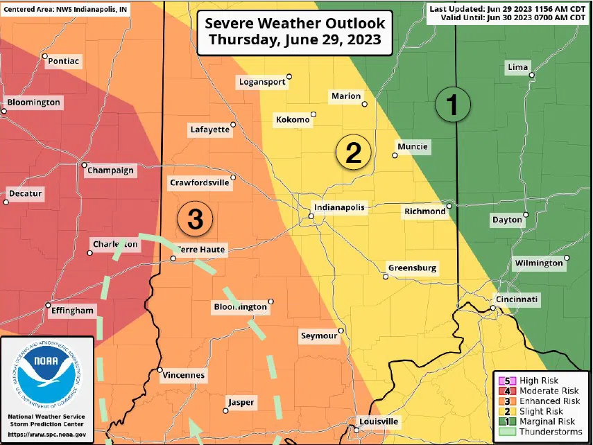
- There is a Slight Risk of severe weather Friday afternoon and night.
- There is a Slight Risk of severe weather Saturday afternoon and night.
Timing:
- Friday – Afternoon and night (Slight Risk)
- Saturday – Afternoon and night (Slight Risk)
Main Hazards:
- Large hail
- Damaging wind gusts – gusts 60-75 mph
- Isolated tornadoes
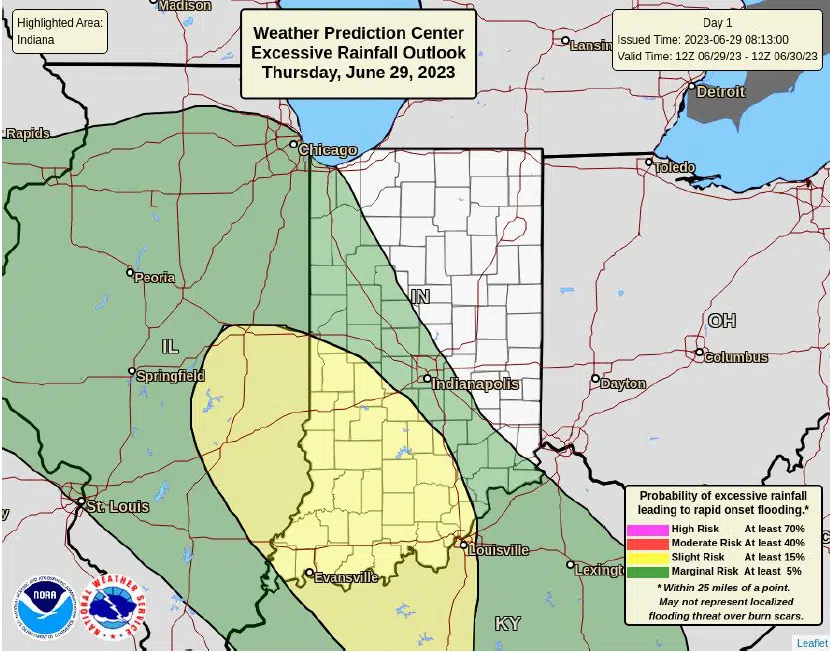
- Heavy rainfall
- Flood threat in the southwest corner of the state (Terre Haute to Bloomington to just east of Jasper line and southwest)
- Lightning
Courtesy – BCEM.
Courtesy – BCEM.


